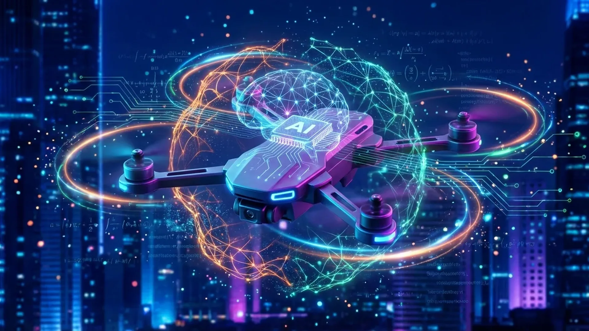
\U0001F440 Computer Vision: The \u201CEyes\u201D of AI Drones
The foundation of every smart drone is computer vision \u2014 the ability of a machine to interpret images and video in real time. In modern drones, this means multiple cameras creating 3D maps of the environment using SLAM (Simultaneous Localization and Mapping) techniques.
The American company Skydio, founded in 2014 by MIT researchers (Adam Bry, Abe Bachrach, Matt Donahoe \u2014 former members of Google Project Wing), represents the best example of an AI-first approach. Its first drone, the Skydio R1 (2018), used 12 navigation cameras and an NVIDIA Jetson TX1 processor to autonomously avoid obstacles and follow the user through dense forest. The evolution continued with the Skydio 2 (2019) which reduced the cameras to 6 but upgraded the processor to NVIDIA Jetson TX2, offering 4K video at 60fps and 23 minutes of flight time.
On the other side, DJI \u2014 which holds approximately 80% of the global drone market (2025 data) \u2014 uses systems like APAS (Advanced Pilot Assistance System) and 6-directional obstacle sensing (omnidirectional obstacle sensing) across the entire Matrice series. DJI\u2019s drones don\u2019t wait for commands \u2014 they scan the environment, calculate alternative routes and bypass obstacles automatically.
SLAM: How a Drone Maps the World While Flying
SLAM (Simultaneous Localization and Mapping) is perhaps the most critical AI technology in drones. It allows the drone to build a 3D map of the environment simultaneously with determining its own position within it. It doesn\u2019t require GPS \u2014 it works indoors, in tunnels, under bridges and in any environment where GPS is unreliable. It combines data from cameras, IMU (inertial measurement unit with 6 to 11 degrees of freedom) and LiDAR to create a continuous picture of the environment in real time.
\U0001F3AF Object Detection and Tracking: The \u201CBrain\u201D that Sees and Follows
Beyond obstacle avoidance, AI drones can recognize what they see. Through deep learning models (CNNs \u2014 Convolutional Neural Networks), the drone identifies people, vehicles, animals or buildings and tracks them as they move.
DJI has developed the ActiveTrack system that automatically recognizes and follows targets while simultaneously avoiding obstacles, as well as FocusTrack which combines ActiveTrack, Spotlight and Point of Interest into a single package. The user simply selects the target on the screen and the drone does the rest.
In the case of Skydio, the AI system is even more advanced: the drone follows the user through dense trees, avoiding branches and trunks, while maintaining a steady frame on the target. This is possible thanks to the processing of millions of pixels per second by the NVIDIA Jetson processors.
Autonomy Levels: From Follow-Me to Fully Autonomous
Modern drones offer graduated levels of autonomy. They start from basic functions like self-leveling (automatic stabilization), altitude hold (altitude maintenance), hover (stable hovering) and reach advanced ones:
- Follow-Me: The drone automatically follows the operator using GPS or computer vision
- GPS Waypoint Navigation: Predefined flight points that the drone follows autonomously
- Orbit Mode: Rotation around a point of interest at a constant distance
- Return-to-Home (RTH): Automatic return on low battery or signal loss
- Failsafe: Safety procedures that activate automatically in emergencies
\U0001F4BB NVIDIA Jetson: The Processor Powering AI Drones
The heart of artificial intelligence in drones is edge computing \u2014 processing data locally on the device, without needing a cloud connection. And here, NVIDIA dominates.
NVIDIA\u2019s Jetson series is the most popular platform for AI in drones. The Jetson TX1 powered the first Skydio R1, the Jetson TX2 gave life to the Skydio 2, and now the Jetson Orin \u2014 the top of the line \u2014 powers the new Skydio X10 (2023).
The Jetson Orin delivers up to 275 TOPS (Trillion Operations Per Second) and enables the simultaneous execution of multiple neural networks at once \u2014 obstacle avoidance, object recognition, SLAM, and 3D modeling together. This means the drone thinks and reacts in milliseconds, without ever sending data to the cloud.
\U0001F916 Skydio X10: The \u201CSmartest\u201D Drone of 2026
The Skydio X10 (2023) represents the pinnacle of AI technology in drones. Priced at approximately \u20ac9,200\u2013\u20ac11,000 (~$10,000\u2013$12,000) (in Greece available only through authorized representatives), it offers an incredible AI package:
- Cameras: 64MP narrow-angle, 48MP zoom, 50MP wide-angle + FLIR Boson+ thermal camera
- Processor: NVIDIA Jetson Orin for on-board AI processing
- NightSense: Flight in complete darkness without any lighting, using thermal imaging and AI
- 3D Modeling on-board: Creating 3D models directly on the drone, without data transfer
- Connectivity: 5G radio + Skydio Connect multi-band for BVLOS flights
- Design: 4 modular payload bays, IP55, deployment in <40 seconds
Skydio already has approximately 22,000 drones in use by the US military, with $100M revenue in 2023 and a $2.2B valuation. The company exited the consumer market in August 2023, focusing exclusively on professional and military applications where AI is critical. Notably: the Skydio X10 is NDAA compliant (meets US security regulations), unlike DJI\u2019s Chinese-made drones.
\U0001F3ED DJI Dock 2: Autonomous Missions Without an Operator
DJI took AI to another level with the DJI Dock 2 \u2014 a \u201Cdrone-in-a-box\u201D system that enables fully autonomous missions without human intervention. The system (dock + Matrice 3D or 3TD) costs approximately \u20ac18,000\u2013\u20ac27,000 (~$20,000\u2013$30,000) depending on the configuration.
The Dock 2 is 75% smaller and 68% lighter than its predecessor, with IP55 protection and a 10 km operating radius. A key feature: it uses AI vision-based site evaluation that reduces site assessment time from 5 hours to just 12 minutes. It takes off in 45 seconds, charges from 20% to 90% in 32 minutes, and has an internal backup battery for 5+ hours of operation without power.
AI Spot-Check and FlyTo: Smart Missions
Two of the most impressive AI features of the DJI Dock 2:
- AI Spot-Check: The drone flies the same routes autonomously at regular intervals and the artificial intelligence automatically compares images between flights, detecting changes or damage to infrastructure
- FlyTo Tasks: The drone automatically plans the optimal route to the destination, autonomously bypassing obstacles
The system connects to the DJI FlightHub 2 cloud platform, offering cloud-based 3D modeling, live flight control via keyboard/mouse and 4G connectivity. It also features dual RTK antennas for \u00b13 cm accuracy, while requiring maintenance only every 6 months.
Matrice 3D and 3TD: The Dock\u2019s Drones
The Dock 2 works with two drone models:
- Matrice 3D: Wide-angle 4/3 CMOS 20MP with mechanical shutter + tele 1/2\u201D 12MP, ideal for 1:500 scale mapping
- Matrice 3TD: Wide-angle 48MP + tele 12MP + thermal 640\u00d7512 (UHR 1280\u00d71024), IP54, 6-directional sensing, integrated RTK (\u00b13 cm), 400 battery cycles
\U0001F33E AI in Agriculture, Inspections and Mapping
Artificial intelligence in drones isn\u2019t just about navigation \u2014 it\u2019s also about the data analysis that drones collect in flight. The three main sectors:
Precision Agriculture
AI drones analyze multispectral camera images to calculate indices like NDVI (Normalized Difference Vegetation Index) that shows crop health. With AI, the drone can detect plant diseases with accuracy above 98% (according to 2024 research on vision transformers in strawberry crops, Western University topic) and guide precision spraying only to the areas that need it. The DJI Agras T50 (approximately \u20ac13,800\u2013\u20ac18,400 / ~$15,000\u2013$20,000) uses AI to adjust spraying according to terrain and vegetation density.
Infrastructure Inspection
Automatic damage detection on bridges, power pylons, wind turbines and solar panels is one of the most promising sectors. AI compares images from different time periods (like the DJI Dock 2\u2019s AI Spot-Check), detecting cracks, corrosion or changes that the human eye would miss. The DJI Matrice 3TD with its thermal camera detects thermal anomalies in electrical grids before they cause failure.
3D Reconstruction and Mapping
AI has also transformed photogrammetry. Neural networks improve the quality of point clouds and 3D models, automating processes like image stitching and flight trajectory optimization for optimal coverage. The Skydio X10 can even create 3D models on-board, without needing to transfer data to a computer.
Deep Reinforcement Learning and Drones
One of the most promising AI techniques is deep reinforcement learning for flight control. Instead of programming every possible scenario, the drone learns on its own through millions of flight simulations. This allows drones to fly in extreme conditions or perform acrobatic maneuvers that no human pilot could. PX4 autopilot, one of the most popular open-source flight controllers, already supports AI-based functions through companion computers.
\U0001F6E1\uFE0F Anti-Drone AI: The Other Side of the Coin
AI isn\u2019t only used to make drones smarter \u2014 it\u2019s also used to detect and neutralize them. C-UAS (Counter-Unmanned Aircraft Systems) use deep learning to detect drones via radar, acoustic signals and optical images. With the increase of threats from unauthorized drones at airports, critical infrastructure and military bases, the C-UAS market is expected to skyrocket in the coming years.
AI-driven C-UAS include technologies like cognitive radio for smart RF jamming, computer vision for detection from surveillance cameras, and swarm intelligence for coordinated response of multiple systems.
\U0001F52E The Future: 5G, Swarms and Full Autonomy
2026 brings us closer to three major trends that will change drones:
5G and BVLOS Flights
5G offers latency of just 1 ms (versus ~50 ms for 4G), making real-time remote drone control feasible. This opens the way for BVLOS (Beyond Visual Line of Sight) flights \u2014 flights beyond visual contact. The Skydio X10 already features an integrated 5G radio and Skydio Connect multi-band, while the DJI Dock 2 uses 4G connectivity for fully remote missions.
Drone Swarms: Collective Intelligence
Swarm intelligence allows dozens or hundreds of drones to coordinate without central control. Each drone makes local decisions based on its neighbors, exactly like a flock of birds. Applications include mass area mapping, search and rescue, and military operations. The Skydio SRR (Short Range Reconnaissance) program for the US military, valued at $99.8M over 5 years, focuses on fully autonomous flight in GPS-denied environments.
Remote ID and Smart Airspace Management
With Remote ID becoming mandatory in more and more countries, and EASA creating a certification framework for autonomous drones, AI will play a central role in airspace management. Smart UTM (Unmanned Traffic Management) systems will coordinate thousands of drones simultaneously in the air, avoiding collisions and ensuring safe coexistence with manned aircraft.
\U0001F4CA AI Drone Market: Impressive Numbers
The computer vision market \u2014 which powers AI drones \u2014 is growing explosively. According to 2024 data:
- Industry (Machine Vision): $5.22B market size
- Medical: $2.6B
- Military applications: $996.2M
- DJI: ~80% global consumer drone market (2025)
- Skydio: $100M revenue (2023), $2.2B valuation, ~22,000 drones in use by the US military
\U0001F4AD Conclusion
Artificial intelligence isn\u2019t just another feature in drones \u2014 it\u2019s their core. From obstacle avoidance with computer vision to fully autonomous mission execution without an operator, AI is what transforms a drone from a toy into a tool. The Skydio X10 with Jetson Orin and NightSense, the DJI Dock 2 with AI Spot-Check, and the upcoming 5G BVLOS flights show that the future of drones is fully autonomous \u2014 and it\u2019s already here.