📖 Read more: 13,700-Year-Old Skeleton Found in Underwater Mexican Cave
🌊 What Doggerland Was
18,000 years ago, during the last ice age (Pleistocene), Britain wasn't an island. A massive land bridge connected it to continental Europe — stretching from today's Netherlands to Denmark. This land, now called Doggerland (after the shallow Dogger Bank in the North Sea), gradually emerged as glaciers retreated around 12,000 BC and temperatures rose.
By 10,000 BC, Doggerland was a landscape rich with life: lagoons, marshes, rivers, lakes and dense forests covered an area larger than modern Holland. Archaeologists believe it was probably one of the richest hunting and fishing grounds in Europe during the Mesolithic period. Herds of deer, wild boar, waterfowl, river fish — a land no one had reason to abandon.
🦌 Who Lived in Doggerland
Human bone fragments have been recovered by fishermen and dredgers along the North Sea floor. Radiocarbon dating reveals most belong to Mesolithic people — hunter-gatherers who lived in Doggerland between 20,000 and 8,000 years ago. These people had arrived from continental Europe following mammoth and reindeer migrations, adapting to a landscape changing rapidly as ice retreated.
Life in Doggerland was likely semi-nomadic: small groups of hunters moved seasonally between river valleys, coastal areas and forest pockets. They crafted tools from flint, bone and wood. Weapons carved from human bone reveal how these people incorporated death into daily life. Even Neanderthals appear to have inhabited this land in earlier periods.
Population density was low but stable. The area was ideal: rich water, abundant game, fish, plants. No reason to move. Doggerland wasn't a barren zone between two continents — it was inhabited space, a crossroads of cultures. Whatever traveled between Britain and Europe — ideas, tools, people — passed through Doggerland.
📖 Read more: 5,000-Year-Old Sacred Complex Unearthed in Iraq
🌋 The Catastrophe: The Storegga Slide
Around 6200 BC, a colossal underwater landslide off the coast of Norway — the Storegga Slide — displaced over 3,000 cubic kilometers of material into the ocean. This volume equals 300 times the annual sediment of all the world's rivers combined. The slide was likely triggered by seismic activity following Norway's deglaciation — ice that had stabilized the continental shelf vanished, and the land collapsed.
The sudden displacement of water created a mega-tsunami: waves up to 20 meters high swept across the North Sea. The tsunami swallowed Doggerland, struck northeastern Britain and traveled 40 kilometers inland. "If you were standing on the shore that day, it would have been a very bad day for you," said Vincent Gaffney, professor of landscape archaeology at the University of Bradford. "It was catastrophic. Many people, possibly thousands, must have died."
💡 The Numbers of Catastrophe
The Storegga Slide moved 3,000 cubic kilometers of material — the largest known underwater landslide in history. Waves 20 meters high swept across a 500-mile area. Tsunami sediments have been detected in seafloor samples throughout the North Sea — allowing scientists to map the disaster centuries later.
🏝️ The Dogger Archipelago: The Last Islands
For decades, scientists believed Storegga completely destroyed Doggerland. But a 2020 study in the journal Antiquity changed this picture. Sediment cores pulled from the seabed show certain areas remained above water level even after the tsunami. Researchers named them the "Dogger Archipelago" — a group of islands in the central North Sea, including a larger island at the highest points, the so-called "Dogger Hills."
These islands weren't empty. Tsunami survivors must have returned — and some areas may have been even more suitable after the disaster, due to open landscape. Gaffney hypothesizes these islands may have played a crucial role in transmitting agricultural technologies from Europe to Britain. "It's these coastal areas where contact with farming and farmers was most likely," he noted.
But rising seas didn't stop. Between 8,200 and 8,400 years ago, global mean sea level rose 1 to 4 meters — a dramatic increase linked to climate change of that era and rapid melting of massive glaciers in the Canadian and Scandinavian north. Around 7,000 BC, the Dogger Archipelago vanished completely beneath the waves. Britain was now an island — geographically but not culturally cut off from the rest of Europe.
📖 Read more: 5,000-Year-Old Whale Hunters Found in Brazil
Rich Fishing
Rivers, estuaries, lagoons — Doggerland was a fisherman's paradise. Fish bones and marine fossils found in seafloor samples prove steady human diet from aquatic sources.
Bone Weapons
Tools and weapons made from human bone have been recovered from the North Sea. The finds show complex ritual practices and use of bodily materials in daily life.
Modern Research
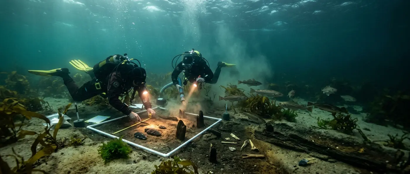
The Europe's Lost Frontiers program uses seismic scanners, sediment cores and 3D modeling to reconstruct the ancient landscape — without finding a settlement yet.
🔬 The Search for the First Settlement
Over the past 20 years, our knowledge of Doggerland has been revolutionized. The Europe's Lost Frontiers program, based at the University of Bradford, leads the research. Research vessels — including the Belgian RV Belgica — collect sediment cores from the seabed. Each core reveals layers of history: pollen from ancient forests, plant seeds, animal bones, even the tsunami sediments themselves. Seismic scanners create maps of sunken river valleys, ancient coastlines and lakes.
Archaeologists know the world exists down there. They know the forests, rivers, animals. But they haven't found what would open a new chapter: an archaeological settlement. "The last 20 years have revolutionized how we understand Doggerland," Gaffney said. "We go down into sunken river valleys, take environmental data, information about the plants and animals that lived there. But we don't have a single archaeological settlement yet. It's essentially an unexplored landscape."
📖 Read more: Ancient Greek Art: The Conquest of Beauty
🌍 Why Doggerland Matters Today
What happened to Doggerland offers a warning. A massive land area was submerged due to rising sea levels and cataclysmic natural events. Today, climate change is raising seas again: according to scientists, levels could rise 1-2 meters by 2100. Coastal areas worldwide — from Bangladesh to the Netherlands, Florida to Pacific islands — face the same issue.
Doggerland shows how quickly a landscape can change. Around 10,000 BC it was rich land. Around 7,000 BC it no longer existed. The transition wasn't instantaneous — it came in phases, each more catastrophic than the last. First gradual sea level rise, then tsunami, then final submersion. Thousands of people were forced to migrate — to England or to the Low Countries.
⚖️ Doggerland Timeline
🏺 The Lost World Still Waiting
Every year, fishing nets drag along the North Sea floor and pull up objects: mammoth teeth, animal bones, even flint tools. Each one is a fragment of Doggerland — a piece of a world that existed and vanished. The Dogger Archipelago islands, especially the higher points, remain the most promising spots for locating archaeological settlements.
If a Doggerland village is ever found — houses, graves, tools in archaeological context — it will open an entirely new chapter in European prehistory. We'll learn how these people lived, what they believed, how they dealt with the gradual destruction of their world. We'll better understand the transition from Mesolithic to Neolithic in northern Europe — a transition that likely crossed precisely through this sunken land.
Technology is advancing rapidly: underwater drones, high-resolution seismic scanners, ancient DNA analysis from seafloor sediments — all leave open the possibility of discovery. The North Sea, with its shallow waters and extensive sedimentary fields, is ideal for such research — if there's funding and political will. For now, Doggerland remains Europe's largest unexplored archaeological site — an entire kingdom, submerged in 20 meters of water, waiting for the first shovel.